The Saint Lawrence River
Between you and I…
1.6 million km2! That’s the surface area of my watershed. Amazing isn’t it? So, you wouldn’t be surprised to learn that I’m the 3rd largest river in North America in terms of hydrographic system, after the Mississippi –which flows from northern Minnesota to the Gulf of Mexico – and the Mackenzie – which flows from the Great Slave Lake in Canada until it reaches the Arctic Ocean. Along with the Great Lakes (which belong to the same hydrological system), I represent more than 25% of the world’s freshwater reserves. My watershed, discharge and length make me a giant. You’re probably asking who I am, considering I’m so modest. Well, my name’s Saint Lawrence.
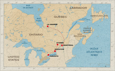
A major gateway into the North American continent, my source lies in Kingston, in Lake Ontario, the most westerly of the five great lakes of North America. I stretch for 1,197 km and cross the cities of Montreal and Quebec before reaching the Gulf of Saint Lawrence and the Atlantic Ocean.
Technical sheet
- Source: Ontario Lake.
- Mouth: Gulf of Saint Lawrence, Atlantic Ocean.
- Average discharge: 7,543 m3/s (Cornwall); 12,309 m3/s (Quebec).
- Total length: 1,197 km.
- Watershed: 1,600,000 km².
- States crossed: United States, Canada.
- Tributaries: 244, main tributaries : Outaouais, Saguenay, Manicouagan, Saint-Maurice, Outardes rivers.
A little history
 The Amerindian populations of the region call me Hochelaga, “the path that walks”. I’m also known as the Great River of Canada. However, the name I finally ended up with is Saint Lawrence, which I owe to the explorer Jacques Cartier who discovered me in 1535, and took possession of my course in the name of the king of France, Francis I. Was he aware of how important I am and, above all, could he have imagined the capacities I could provide once developed?
Very quickly, I became the main route for navigators come to discover the North American continent. The colonists founded the cities of Quebec and Montreal on my banks and built their wealth on trading furs and farming. Over the decades, my utilisation as a river corridor increased. It’s a vocation that must now take into account the development of other new and sometimes conflicting uses.
 Since the beginning of the 20th century, I have been subject to international cooperation to better protect my waters and those of the Great Lakes, and solve cross-border conflicts, notably regarding massive transfers of water away from my catchment area to regions of southwest America to irrigate farmland. As far back as 1909, an International Joint Commission was set up to ensure shared governance between the United-States and Canada.
In 2009, a law was passed to reassert the collective nature of water resources and strengthen their protection over the entire basin.
A river with long stretches
Schematically, the Saint Lawrence River can by divided into 4 stretches as a function of its discharge:
–The stretch between Kingston and Lake Saint Pierre: on leaving Lake Ontario, the river forms the border between Canada and the United States for 183 km. It enters Canada at Kingston. Its course broadens to form a series of lakes, artificial like Saint-Lawrence (created by the Cornwall dam) and natural like the lakes of Saint-François and Saint-Louis.
–From the Lake Saint-Pierre to the eastern point of the Orleans island, the freshwater of the river estuary is influenced by ocean tides up to Trois-Rivières. The freshwater comes from the Great Lakes.
–From Orleans island to the mouth of the Saguenay and the western point of the green island, that’s to say the middle estuary with brackish water, is where the freshwater and saltwater meet.
–From Tadoussac to the Pointe-des-monts, the maritime estuary, where the Laurentian channel begins. This is a deep natural channel with saltwater rich in nutrients that opens out into the Gulf.
I play an essential role in transport, energy and tourism
History of river navigation
Up to 1825, navigation on my waters was limited by natural constraints, blocked by the Lachine rapids at Montreal. The Lachine canal, the first structure built for navigation, was opened upstream of Montreal in 1825 to overcome the first barrier to commercial navigation. Its success continued, especially with the dredging of the river between Quebec and Montreal from 1851 onwards.
Today, the Seaway (completed in 1959) has replaced the Lachine canal and links Montreal with
 Kingston and Lake Ontario. 306 km long, it comprises 7 locks, i.e. 5 Canadian and 2 American. Every year, no fewer than 200 million tonnes are transported through the Seaway to be loaded and unloaded at around forty ports. Thus 4,000 movements of ships from mid-March to the 4th week of December, the start of the seasonal shutdown of the Seaway, before the freezing winter! The Seaway can accommodate very large ships.
Key figure:
1 large boat (up to 220 metres long, 24 metres wide and with a draught of 8 metres) can replace 850 trucks. That means less pollution and a plus for the environment.
When sailing upstream to Lake Superior, from Montreal, one must pass via lakes Ontario, Erie and Huron. To ensure the smooth passage for boats sailing on this corridor it was necessary to build 17 locks and various diversions including the famous 44 km long Welland canal, which permits bypassing the Niagara Falls, where the waters of Lake Erie fall into Lake Ontario. Completed in 1932 and then deepened in the 1950s in the framework of the Seaway project, the canal was straightened in 1973.
A maritime route called the H2O Highway stretches for 3,700 km from the North Atlantic Ocean (the port of Halifax) to Lake Superior. The Great Lakes and I belong to it, as do some 40 partner ports. Devoted to the development of regional trade and services, this maritime highway gives rise to an alliance between actors in the transport sector.
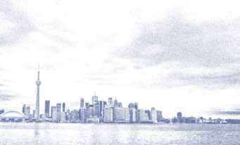
The Port of Montreal
- Surface area: 26 km long (Victoria Bridge – Pointe-aux-Trembles)
- The only container port on the Saint Lawrence River, with 3 international terminals already built and a new terminal planned at Contrecoeur, 40 km upstream on the south bank of the river.
- Depth: 11 m
- Traffic: 38 million tonnes of goods (2017) of which nearly 14 million tonnes are containerised; 1.5 million containers TEU from large trading areas: Europe (36% of the port’s international traffic), Asia (24%)) and the Mediterranean (21%); more than 2,000 ships a year.
- Passenger cruisers: 114,518 passengers and crew received in 2017.
- Governance: Port Authority of Montreal (PMA).
Traffic from here and elsewhere
Three quarters of the goods that transit along me come from international transport:
- Imports: the products that enter Quebec thanks to me mainly come from Europe, Central America, South America, Africa and the United States. Crude oil is one of the main imports, and generally comes from Northern Europe and North Africa. More than 9 million tonnes are unloaded in the port of Quebec every year.
- Exports: Europe is my best client! Followed by the United States and Asia-Oceania.
More than 100 million tonnes/year: that’s the volume of goods transported between the head of the lakes and the ports of the estuary (Baie Corneau, Port-Cartier, Sept-îles) including: 38 Mt on the Seaway and 40 Mt on the Welland canal.
More than 200 million tonnes of goods are transported if the entire network of the Great Lakes and the Seaway are added together.
Water, a source of energy
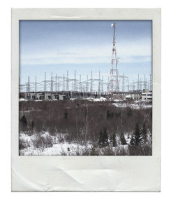
 Abundant in Quebec, water rapidly became the main source of electric energy. Large hydropower plants were built on my tributaries (Saguenay, Outaouais etc.) in the 1920s and 30s. Beauharnois is the plant that was installed on my course. Originally private initiatives, these hydropower plants were partly nationalised following the establishment in 1944 of Hydro-Québec, a public company responsible for the production, transport and distribution of electricity in Quebec. However, Hydro-Quebec’s investment in major hydropower projects in the 1950s and afterwards principally involved the rivers in the north of Quebec, since I am above all used for navigation.
Operation seduction

To promote tourism and attract passengers, the regions of the maritime estuary and the gulf have gathered in a federation of associations: Québec Maritime. The Lower Saint Lawrence, with its Route of Navigators that showcases the region’s maritime heritage, has wagered on my potential.
Cities like Quebec and Montreal also seek to exploit me by offering an array of activities such as visits to old ports, cruises and excursions, and more. Then, there are the marine parks that highlight the fauna I harbour such as belugas, finback whales and blue whales.
201234567890501234567890
% of the world’s reserves of freshwater
201234567890.501234567890
million visitors a year
201234567890001234567890001234567890
million tonnes of goods transported on the entire network Great Lakes / Seaway
What river for tomorrow?
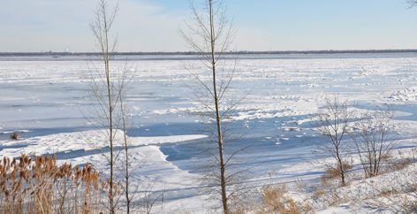
In spite of many efforts and significant improvements over the last 20 years, industrial and agricultural pollution as well as discharges of untreated wastewater still have worrying impacts on my health. Climate change is another threat. The increase in temperatures leads to rises in the evaporation rates of the Great Lakes. This fall in water levels leads to equivalent reductions in water levels in the fluvial section of the Saint Lawrence, leading to many impacts on ecosystems and on maritime transport.
Contaminated waters
To my great dismay, I have long had to put up with discharges of wastewater leading to heavy pollution. Over the last 30 years, different actions taken to clean up this pollution have nonetheless resulted in considerable improvements in the quality of my water. The most important of these actions is the Quebec Wastewater Treatment Program, in which more than $7 billion has been invested since 1978. Luckily, the law is also on my side. Stricter regulations and controls have obliged pollutant industries to treat their effluents, that’s to say their liquid discharges containing a given pollutant load. As for the municipalities, most of them are henceforth obliged to treat their wastewater. Actions that prove global awareness of what harms me on a daily basis make my future brighter, with the preservation of biodiversity and water of better quality, and at the same time guarantee I can fulfil my vital economic role. What’s more, now the water is of better quality, there are several projects to install municipal public beaches along my banks.